
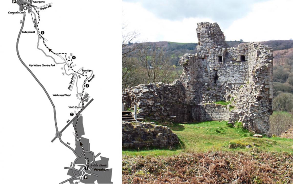
A walk through the historic town of Wrexham, then along sections of Wat's Dyke, the banks of the River Alyn and quiet country lanes to Alyn Waters Country Park, ending in Caergwrle with its 13th century Welsh castle.
As this is a linear walk you will need to arrange transport at both ends.
Distance: 10.5km (6.5 miles)
Parking: Car park below St Giles' Church, Wrexham
Grid ref: SJ335501.
Map: OS Explorer 256
The Walk
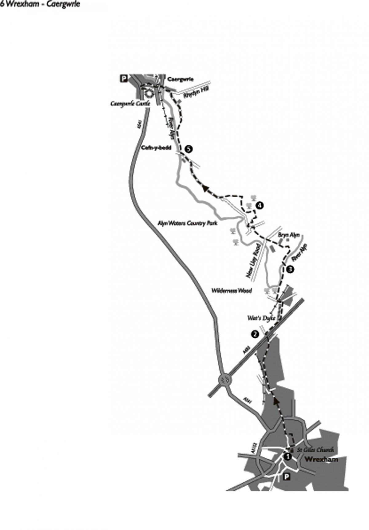
1. This walk starts in Wrexham from St Giles' Church. Turn right along High Street, away from the town centre.
Turn left at the end of High Street in front of the Wynnstay Arms to go along Chester Street. Continue up Chester Street passing
Henblas Street on the left. Carry on up Chester Street past Lambpit Street and the Saith Seren Pub.
Before reaching the war memorial turn left to pass through the old gateway to Llwyn Isaf towards the Guildhall.
Continue on the footpath between the Guildhall and the Library, a modern brick building with a colourful mosaic on the side. Turn right and head up Rhosddu Road passing Trinity Presbyterian Church of Wales on the left. At the roundabout, keep straight ahead.
On the right is the attractive façade of what is now Yale College. In 1918 the people of Wrexham decided to mark the sacrifice of local servicemen who had died during the First World War by building a new hospital. The Prince of Wales laid the foundation stone on
November 2nd 1923 and the hospital served the local community for sixty years. It survived planned demolition and is now home to Yale
College. Near the college entrance is a wellhead from one of Wrexham's old wells and nearby are some pillar bases that may have come from the old Town Hall.
A local resident, William Low, set up the Channel Tunnel Company in 1867. His plan to build a tunnel under the English Channel got backing from Emperor Napoleon III of France and Queen Victoria. He began tunnelling but the Franco-Prussian war in 1870
frightened off investors and the plan folded.
At the next roundabout continue straight on. On the left is Grosvenor Road that was originally a ropewalk where cordswainers made their ropes. Eventually Rhosddu Road joins New Road. Continue on this road, crossing over the busy A483 dual carriageway.
2. Immediately after crossing the A483 turn right down steps, at a footpath sign, then cross a stile. Walk parallel to the A483 for 300m. At the end of the left-hand fence, go half-left for 100m to a wooden stile on the right (NB: This area can be extremely waterlogged in wet periods). Cross stile and follow left-hand field boundary over two stiles to reach Plas Acton Road.
Cross the road but ignore the waymarked path opposite, instead turn left across the railway bridge then right into Pandy Industrial Estate. Continue ahead to cross a stile by a gate then go ahead, bearing left down an indistinct path immediately after the Pandy Waste Water Pumping Station (ignore main track bearing right). Descend down the slope into Wilderness Wood and turn right at the stream along
wooden boardwalks. Continue then cross a stile then half-right before a pond, up the slope.
Cross a further stile and turn left along the track then over a bridge and stile.
3. Turn right over cattle grid to follow surfaced access road away from Wilderness Farm. At the junction with Pont-y-Capel Lane turn left uphill to cross a stile on left after 50m. Follow this path up the slope to emerge in a field with a house (Bryn Alyn) ahead to the right. Go across field to stile. Cross stile and bear right to hidden stile to left of house. Cross lane then stile opposite. Go half-left across field to
kissing gate then down slope to cross New Llay Road. Continue up the opposite slope via a footpath immediately on the left. Ignore first stile on right and continue along the top of woods with green fence on right to a second stile. Cross this stile then go half-left to a stile on the right of a white house.
4. Cross stile and turn left along a surfaced road. Ignore the lane on the left and turn right into Alyn Waters Country Park.
Follow the surfaced cycle track to wooden benches and a white marble sculpture then turn left onto a gravel path. At second bench keep left continuing on the gravel path. After the next bench by a marker post, with DO etched on it, go left through an Active Lifestyles Project Area to re-join the cycle track. Turn left to exit the park through barriers onto Park Road. Turn right and follow the lane for about 1km, past a pond, then turn left along the B5102, Llay Road.
5. Take the waymarked footpath on the right by a Flintshire County Council boundary sign. Follow this well-defined path above the River
Alyn. After 500m cross a stile up the right bank then go half-left across an open field to a wooden bridge. Cross bridge and go half-right to cross a stile on the right of a white house. At footpath junction bear left through the trees to cross another wooden bridge.
Follow the path/bridleway to a metalled road (Rhyddyn Hill). On the left by the River Alyn is the site of the old Caergwrle Spa. First mentioned in 1740, the site was developed in the early 1900s using two local springs whose waters were claimed to have healing and restorative properties. A pump house, bottling house, tea room, and bandstand were built and a bowling green laid out. Trains brought
tourists to the village from Liverpool, Manchester and the Midlands.
6. Turn left down the hill then left onto the A541 (Hawarden Road). Turn right on Castle Street to enter Caergwrle with its choice of pubs and shops.
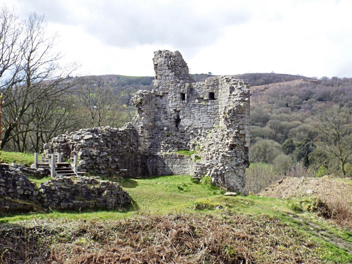
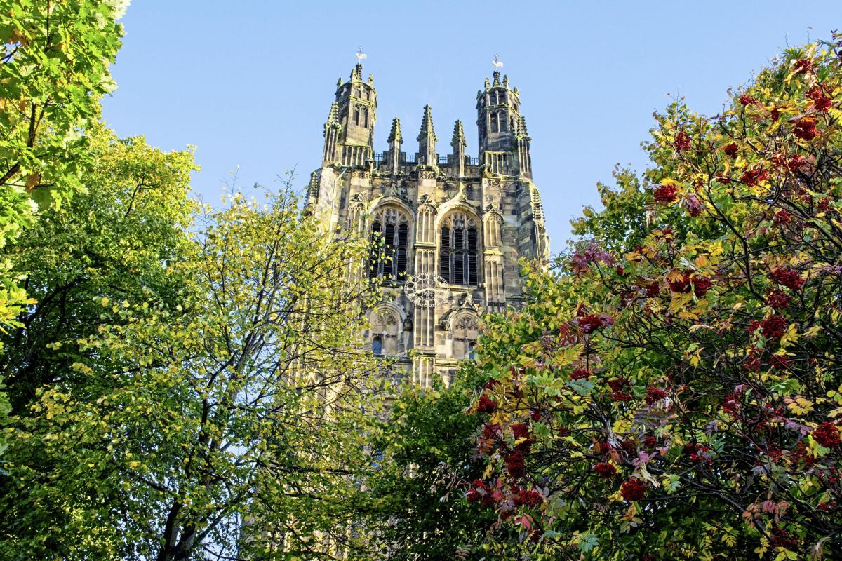
Caergwrle derives it's name from a combination of Welsh and old English terms; caer (fort) + corn (crane, heron) + lea (glade, clearing) thus fort by the heron's glade. Turn left by the phone box then left again just before the war memorial to follow a path uphill. Climb steps and bear right along path up more steps, then follow clear path to the castle ruins on the hilltop.
The dominant feature above the village is the castle built by Dafydd ap Grufydd in 1278. It was probably used as a base for his attack on the English castle at Hawarden in March 1282. By the time Edward I's troops reached Caergwrle in June 1282 they found that Dafydd had dismantled his own castle, blocked the well, and fled.
After exploring the castle retrace your steps to the war memorial. To continue on Wat's Dyke Way turn right and go up the High Street. To return to Wrexham by public transport, either can catch a bus from the High Street or turn left by the Spar shop and follow the road down to the railway station.
Wat's Dyke Way Heritage Trail, by Pete Lewis (ISBN 978-0-9559625-0-9). A book outlining the whole trail along with four circular walks has been published by Mold based publisher Alyn Books and is available from local bookshops, or online at: www.northerneyebooks.co.ukor www.moldbookshop.co.uk.


Comments: Our rules
We want our comments to be a lively and valuable part of our community - a place where readers can debate and engage with the most important local issues. The ability to comment on our stories is a privilege, not a right, however, and that privilege may be withdrawn if it is abused or misused.
Please report any comments that break our rules.
Read the rules here