
HOCKENHULL PLATTS
AN ancient packhorse route, raised causeway across the marshes, marshy nature reserve, three medieval packhorse bridges, quiet riverside
paths, old watermill, and a section of Roman Watling Street
Start: Centre of Tarvin village, 4 miles/7 kilometres east of Chester. Map reference: SJ 490670.
Distance: 5 miles/8 kilometres.
Duration: Allow 3 hours.
Difficulty: Virtually flat. Lanes, surfaced paths, riverside and field paths. Wet in places.
Food and drink: George and Dragon, High Street, Tarvin, 01829 741863.
Maps: OS 1:25,000 Explorer 266 Wirral and Chester/Caer, and 267 Northwich and Delamere Forest; OS 1:50,000 Landranger 117 Chester.
It is hard to believe, but for almost 1,400 years after the Romans left Britain in around AD410, no proper new roads were built. The Roman roads, themselves often based on earlier tracks, continued in use throughout the Middle Ages; and parts still exist today.
The walk
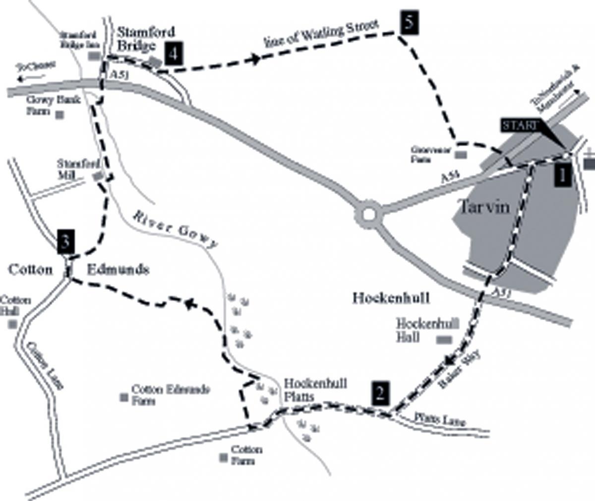
The walk begins in the centre of the quiet Cheshire village of Tarvin.
1. Walk west along the High Street towards Chester. Two hundred metres later, turn left into Hockenhull Lane and continue through the
housing estate for around 1/4 mile/500 metres. When the road bends to the right, continue straight ahead on Hockenhull Lane - now signed as a dead end. Cross the busy A51 Tarvin bypass to the lane directly ahead. For a while, the route joins a section of the long distance Baker Way. When the lane turns right towards Hockenhull Hall, some 350 metres later, continue straight ahead to join an enclosed pathway between fields.
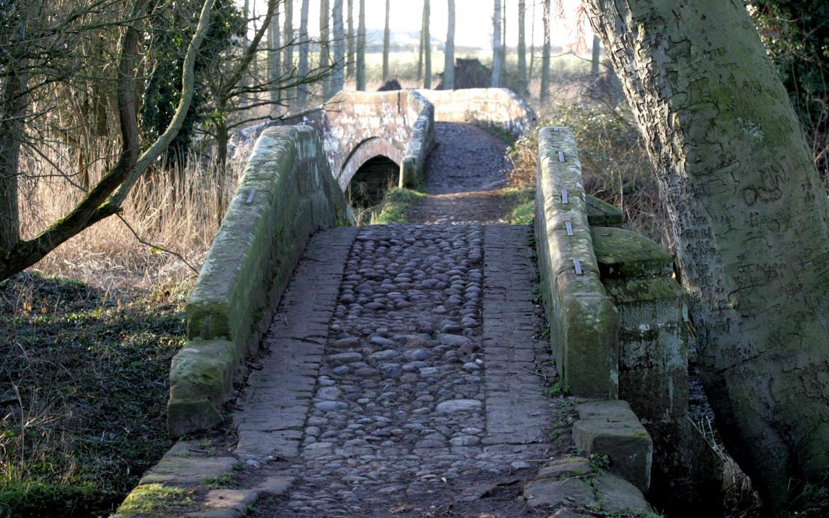
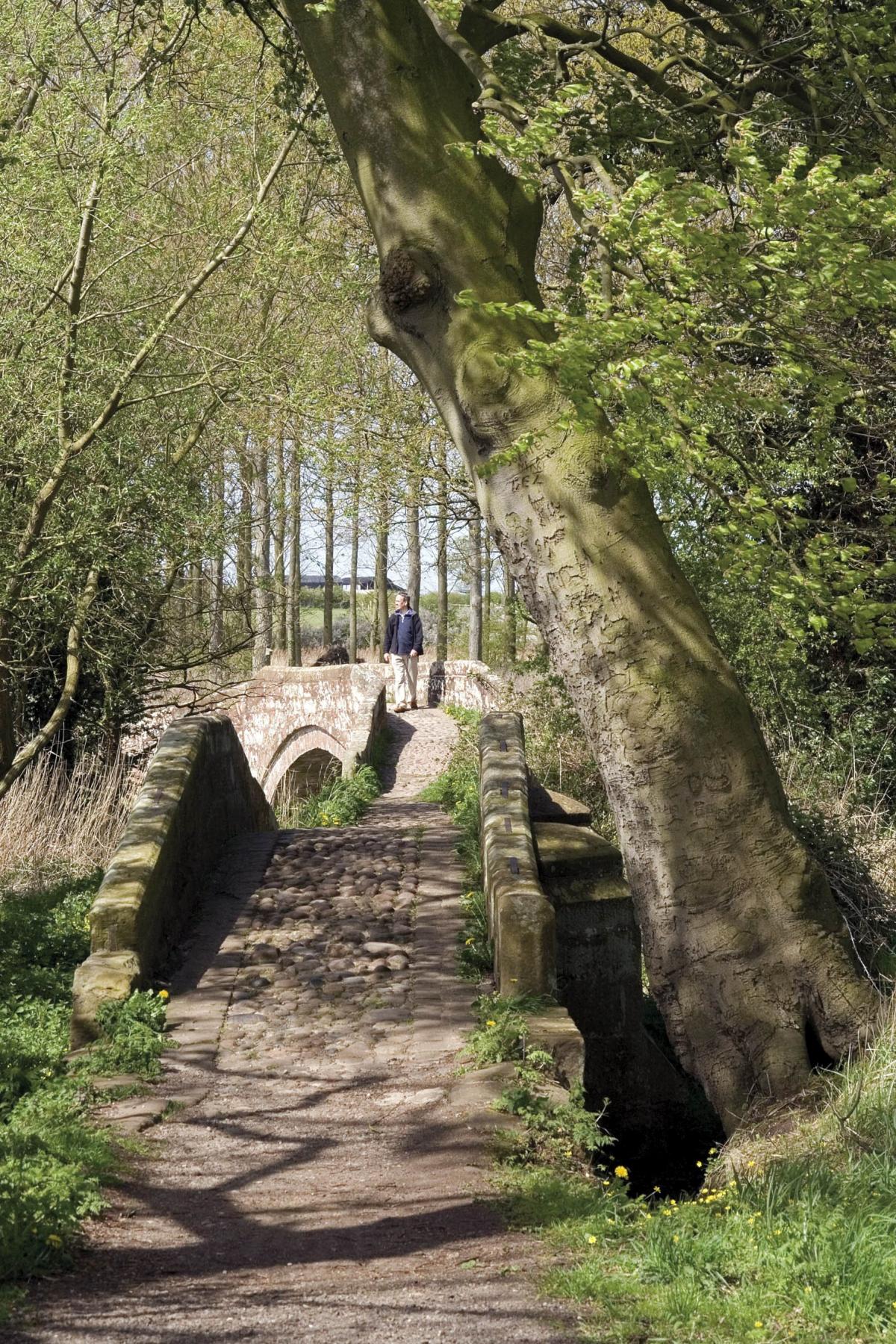
2. When the path meets a T-junction with another rough unsurfaced track, turn right, onto ancient Platts Lane. The track winds its way down to the River Gowy. This is Hockenhull Platts.
Cross the old sandstone packhorse bridges. When the old track emerges between posts onto a surfaced lane rising away from the Gowy, turn right, over a stile. Follow the fence alongside the plantation beside the first field to a stile in the top right-hand corner. Then turn right, over a stile, to rejoin the River Gowy. Turn left at the river and follow the bank downstream. A hundred metres beyond a right-hand bend in the river, veer left and trace the field boundary towards another stile in the far fenceline, 50 metres or so from the corner of the field.
Cross the next small field to a footbridge across a ditch. Turn right, along the hedge, and climb over another stile. Head straight across the next field to a stile beside a gate; then skirt the margins of another large field.
Towards the far side, head for a stile beside a gate that opens onto Cotton Lane. Once over the stile, turn right along Cotton Lane.
3. Roughly 150 metres later, look for a signposted footpath leading out across the fields. The path crosses the centre of the field, and then kinks left at the fence immediately before a ditch. Now head towards the farm at Stamford Mill, at the end of Mill Lane.
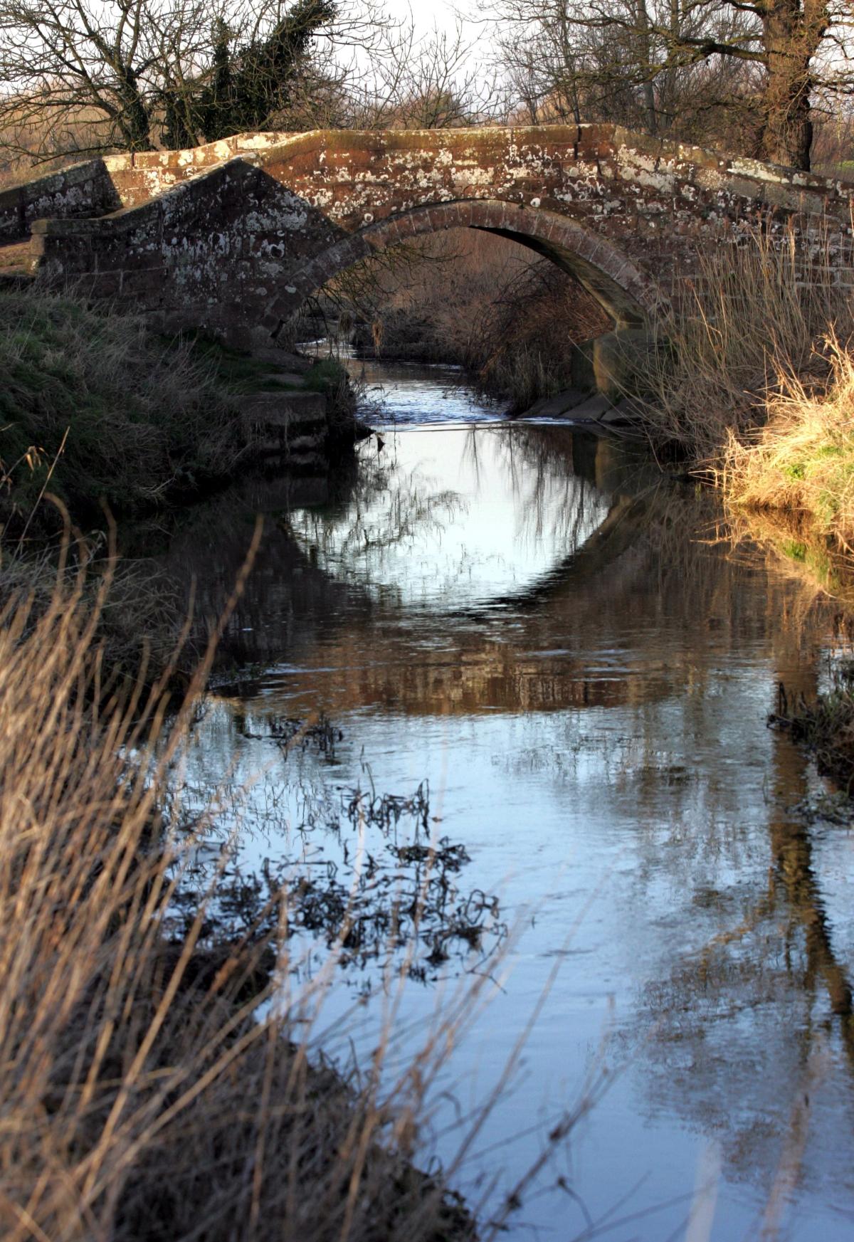
Cross a footbridge over a drainage ditch and head towards the farm, aiming for a gate to the left of the house and outbuildings. Once through the gate, turn right, and pass through the farmyard. Beyond the farmhouse, the path crosses the narrow River Gowy on another bridge.
Turn left immediately after the bridge and follow the path beside the river. Within 150 metres of the busy A51 ahead, turn right across a field, and take a footbridge over the ditch. Turn left and cross a second footbridge to the road. Take great care crossing the busy main road, and then turn left, up the road opposite, towards Great Barrow. Nearby is the Stamford Bridge Inn - a good place for a thirst-quenching break or even lunch.
4. Opposite the Stamford Bridge Inn, turn right into a redundant loop of the old Chester-Manchester highway, now called Lansdowne Road. Beyond the houses, take the signed footpath on the left. For the next 1/2 mile/1 kilometre or so, the footpath traces the route of the Roman road as it runs on across the modern fields towards Kelsall hill, Organsdale field, Eddisbury hillfort, and Oakmere to the Roman station at Northwich (Condate).
Keep to the left-hand edge of the field to cross a footbridge in the far corner. Cross another small field and a second footbridge, and continue along the left-hand hedgeline. Continue through the fields ahead.
5. When the path meets a footbridge on the left, about 3/4 mile/1 kilometre from Lansdowne Road, veer right, across the fields towards Tarvin. Although the Roman road runs on, gently uphill towards Kelsall, we turn aside onto the old footpath. Soon Tarvin church comes
into view. Cross the stile and footbridge in the field corner and continue alongside the hedge. Just before farm buildings, turn left over a footbridge and keep to the field boundary on the right. A gate on the right leads out onto the A54. Cross the main road with care and
walk along the short road opposite. At the T-junction, turn left and walk back into the centre of Tarvin village to complete the walk.
This walk is taken from the book 'Walks in Mysterious Cheshire and Wirral' (ISBN 978-0-9553557-0-7) by Tony Bowerman, published by Northern Eye Books. Copies can be bought locally or ordered online at: www.northerneyebooks.co.uk


Comments: Our rules
We want our comments to be a lively and valuable part of our community - a place where readers can debate and engage with the most important local issues. The ability to comment on our stories is a privilege, not a right, however, and that privilege may be withdrawn if it is abused or misused.
Please report any comments that break our rules.
Read the rules here